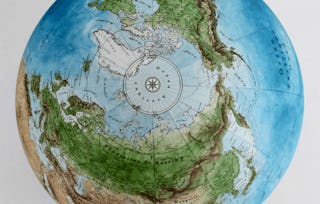
Coursera

Spatial Analysis, 3D Data & Machine Learning

通过 Coursera Plus 提高技能,仅需 239 美元/年(原价 399 美元)。立即节省

Coursera

Spatial Analysis, 3D Data & Machine Learning

Coursera

位教师:Coursera

包含在 Coursera Plus

深入了解一个主题并学习基础知识。
初级 等级

推荐体验

1 周 完成
在 10 小时 一周
灵活的计划
自行安排学习进度
深入了解一个主题并学习基础知识。
初级 等级

推荐体验

1 周 完成
在 10 小时 一周
灵活的计划
自行安排学习进度

您将学到什么

  • Apply spatial statistics and interpolation techniques

  • Work with LiDAR and 3D geospatial data

  • Train machine learning models on geospatial datasets

  • Use deep learning for imagery classification

要了解的详细信息

可分享的证书

添加到您的领英档案

最近已更新!

April 2026

授课语言:英语(English)

了解顶级公司的员工如何掌握热门技能

Petrobras, TATA, Danone, Capgemini, P&G 和 L'Oreal 的徽标

积累特定领域的专业知识

本课程是 Mastering Geospatial Data Science: From Beginner to Expert 专项课程 专项课程的一部分
在注册此课程时,您还会同时注册此专项课程。
  • 向行业专家学习新概念
  • 获得对主题或工具的基础理解
  • 通过实践项目培养工作相关技能
  • 获得可共享的职业证书

该课程共有13个模块

In this module, you will explore how spatial patterns differ from random distributions and why that difference matters in real-world analysis. Using air-quality sensor data as a motivating example, you will examine how Global Moran’s I quantifies spatial autocorrelation in polygon data and helps analysts identify clustering patterns that might otherwise go unnoticed.

涵盖的内容

1个视频1篇阅读材料2个作业

In this module, you will examine how spatial analysts estimate values between discrete measurement locations. Using air-quality sensor data as a motivating example, you will be introduced to Inverse Distance Weighting (IDW) interpolation and learn how distance-based assumptions are used to generate continuous surfaces from point observations. You will explore how parameter choices influence interpolation results and learn how to interpret estimated surfaces responsibly in real-world spatial analysis contexts.

涵盖的内容

2个视频1篇阅读材料2个作业

In this module, you will step back from computation to interpretation, focusing on semivariograms as diagnostic tools for spatial structure. By learning how to read range, sill, and nugget, you will gain intuition about spatial dependence, knowledge that informs both analysis choices and communication with non-technical audiences.

涵盖的内容

2个视频1篇阅读材料2个作业

Learners understand what LiDAR point clouds represent and can confidently load and explore them in a 3D environment.

涵盖的内容

1个视频2篇阅读材料1个作业

Learners understand why DEMs are derived products and can create one correctly from ground-class LiDAR points.

涵盖的内容

1个视频2篇阅读材料2个作业

Learners evaluate whether a DEM is fit for purpose by comparing it against known reference elevations.

涵盖的内容

1个视频2篇阅读材料2个作业

You will explore why raw imagery alone is insufficient for supervised classification and how engineered features improve model performance. The lesson focuses on practical extraction of spectral bands and texture metrics used in land-cover analysis.

涵盖的内容

1个视频2篇阅读材料2个作业

You will apply engineered features to train a Random Forest classifier. Emphasis is placed on intuition: how trees vote, how parameters affect performance, and how to avoid beginner mistakes.

涵盖的内容

1个视频2篇阅读材料2个作业

You will evaluate whether the model meets job requirements by interpreting confusion matrices and accuracy metrics. The lesson emphasizes decision-making, not just calculation.

涵盖的内容

1个视频2篇阅读材料2个作业

In this module, you will apply transfer learning techniques to fine-tune a pre-trained convolutional neural network (CNN) for land cover classification using satellite imagery. The module focuses on adapting existing vision models to geospatial data under real-world constraints such as limited labeled samples, class imbalance, and spatial generalization challenges.

涵盖的内容

1个视频2篇阅读材料2个作业

In this module, learners design and apply data augmentation pipelines to improve the generalization of convolutional neural networks trained on satellite imagery. The module focuses on selecting realistic augmentations that preserve spatial meaning while addressing limited and imbalanced land-cover data.

涵盖的内容

2个视频2篇阅读材料1个作业

In this module, learners use Grad-CAM visualizations to interpret convolutional neural network predictions for satellite imagery. The module emphasizes understanding model attention, identifying failure modes, and communicating model behavior clearly to technical and non-technical stakeholders.

涵盖的内容

1个视频2篇阅读材料2个作业

In this project, you will build a geospatial machine learning workflow to classify land cover using imagery, LiDAR-derived elevation data, and labeled samples. You will engineer features, train a model, validate the results, and generate a classified land cover output. You will also summarize model performance and create an interpretation output to explain how the model behaves. This project requires learners to demonstrate spatial analysis, 3D data use, machine learning implementation, validation, interpretation, and stakeholder communication in one authentic workflow.

涵盖的内容

2篇阅读材料1个作业

获得职业证书

将此证书添加到您的 LinkedIn 个人资料、简历或履历中。在社交媒体和绩效考核中分享。

位教师

Coursera
19 门课程3,242 名学生

提供方

Coursera

从 Machine Learning 浏览更多内容

人们为什么选择 Coursera 来帮助自己实现职业发展

Felipe M.

自 2018开始学习的学生
''能够按照自己的速度和节奏学习课程是一次很棒的经历。只要符合自己的时间表和心情,我就可以学习。'

Jennifer J.

自 2020开始学习的学生
''我直接将从课程中学到的概念和技能应用到一个令人兴奋的新工作项目中。'

Larry W.

自 2021开始学习的学生
''如果我的大学不提供我需要的主题课程,Coursera 便是最好的去处之一。'

Chaitanya A.

''学习不仅仅是在工作中做的更好:它远不止于此。Coursera 让我无限制地学习。'
Coursera Plus

通过 Coursera Plus 开启新生涯

无限制访问 10,000+ 世界一流的课程、实践项目和就业就绪证书课程 - 所有这些都包含在您的订阅中

通过在线学位推动您的职业生涯

获取世界一流大学的学位 - 100% 在线

加入超过 3400 家选择 Coursera for Business 的全球公司

提升员工的技能,使其在数字经济中脱颖而出

常见问题

¹ 本课程的部分作业采用 AI 评分。对于这些作业,将根据 Coursera 隐私声明使用您的数据。