This course equips learners with the skills to utilize Python and open-source libraries for building lightweight, portable GIS desktop applications. It emphasizes practical, hands-on techniques for integrating geospatial data and tools, allowing both beginners and experienced developers to engage in advanced spatial analysis.

Python Geospatial Development Essentials
即将结束: 只需 199 美元(原价 399 美元)即可通过 Coursera Plus 学习新技能。立即节省

您将学到什么
Design and structure a basic GIS application using existing tools
Customize Tkinter widgets to create a reusable GIS toolkit
Load, manipulate, and visualize both vector and raster spatial data
您将获得的技能
要了解的详细信息

可分享的证书
添加到您的领英档案
最近已更新!
January 2026
作业
8 项作业
授课语言:英语(English)
了解顶级公司的员工如何掌握热门技能

该课程共有8个模块
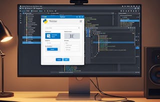
In this section, we explore building a GIS application using Python and Tkinter, focusing on user-friendly design, geospatial libraries, and practical implementation for specific tasks.
涵盖的内容
2个视频3篇阅读材料1个作业
In this section, we implement data interfaces for vector and raster geospatial data, analyze format-specific loaders, and design lightweight solutions for practical GIS applications.
涵盖的内容
1个视频7篇阅读材料1个作业
In this section, we design a structured Tkinter GUI for a GIS application, focusing on modular widget creation and layout testing for efficient development.
涵盖的内容
1个视频5篇阅读材料1个作业
In this section, we explore dividing geographic data rendering into thematic layers, implementing vector and raster graphics, and linking them to an interactive map UI for efficient visualization.
涵盖的内容
1个视频6篇阅读材料1个作业
In this section, we create tools for inspecting geographic data, implement batch operations for vector and raster layers, and design parameter dialogue windows for management functions.
涵盖的内容
1个视频4篇阅读材料1个作业
In this section, we implement vector data overlay and raster zonal statistics, and integrate analysis tools into user interfaces for practical geographic data analysis.
涵盖的内容
1个视频2篇阅读材料1个作业
In this section, we assign a custom icon, create a self-contained executable using py2exe, and design an installer for easy distribution of the application.
涵盖的内容
1个视频4篇阅读材料1个作业
In this section, we explore enhancing the GIS application's user interface, adding advanced GIS features, and expanding platform compatibility for broader usability.
涵盖的内容
1个视频3篇阅读材料1个作业
位教师

提供方


从 Software Development 浏览更多内容
 状态:免费试用
 状态:免费试用
Rice University
 状态:预览
状态:预览Simplilearn

人们为什么选择 Coursera 来帮助自己实现职业发展

Felipe M.
自 2018开始学习的学生
''能够按照自己的速度和节奏学习课程是一次很棒的经历。只要符合自己的时间表和心情,我就可以学习。'

Jennifer J.
自 2020开始学习的学生
''我直接将从课程中学到的概念和技能应用到一个令人兴奋的新工作项目中。'

Larry W.
自 2021开始学习的学生
''如果我的大学不提供我需要的主题课程,Coursera 便是最好的去处之一。'

Chaitanya A.
''学习不仅仅是在工作中做的更好:它远不止于此。Coursera 让我无限制地学习。'

常见问题
Yes, you can preview the first video and view the syllabus before you enroll. You must purchase the course to access content not included in the preview.
If you decide to enroll in the course before the session start date, you will have access to all of the lecture videos and readings for the course. You’ll be able to submit assignments once the session starts.
Once you enroll and your session begins, you will have access to all videos and other resources, including reading items and the course discussion forum. You’ll be able to view and submit practice assessments, and complete required graded assignments to earn a grade and a Course Certificate.
更多问题
提供助学金,